Every year I try to attend the BMW Motorcycle Owner’s Association Rally. This is an annual event that changes locations each year to allow people from all over the country to attend. This year, the location chosen was the Wilson County Fairground in Lebanon, TN.
When I took a quick look at the map, I was quick to realize that it would be a fairly boring ride to get there, so I decided it was time to make the route a bit longer, and more fun. I had a few ideas on how I could make it more interesting, but most of them seemed to include two main themes: The Blue Ridge Parkway and the infamous “Tail of the Dragon”.
So, after some time in front of google maps, motorcycleroads.com and furkot.com, I came up with a fairly compelling route and a new plan. This time, I was going to pick my place to stay from the road. That way, I didn’t have to really push it for a long day to get to a scheduled arrival point and I could be a lot more flexible in my riding as the day developed. I also decided I wasn’t going to camp on the way to the rally (just at the rally), so operation “cheap hotels” became a part of the trip.
DAY 1: Departing the land of boring roads
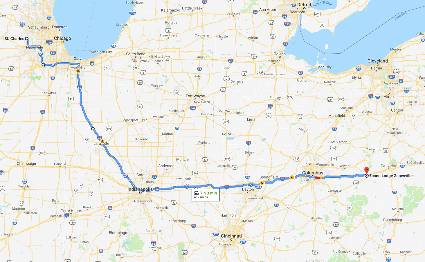
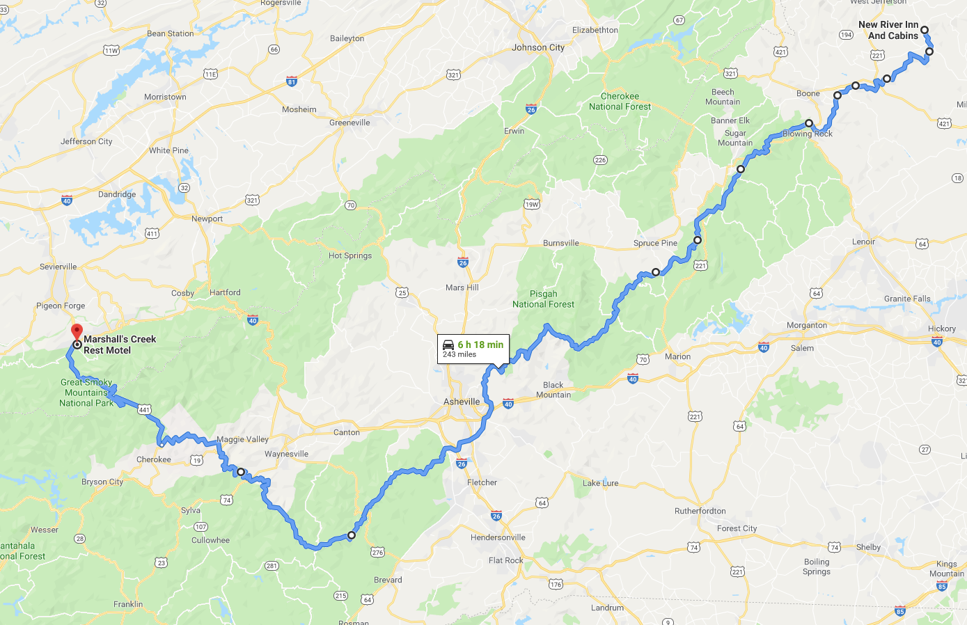
If you take a quick glance at the map above, you’ll see what I saw, lame, boring, straight roads, almost all of which are interstate.
The first day’s travel was boring, by design. I just wanted to get to the real start of the fun riding. Amusingly enough, the launching-off point was Zanesville, OH. Why Zanesville? Because that’s where a great motorcycle road, OH-555, starts. This road is known as the “Triple Nickel”, for obvious reasons, and it has a reputation as a great ride. So, I decided this is where I would start the fun.
However, I had to get there first. So I made my way down to I-88 in Illinois, caught I-355 south (made a quick stop at my sister’s house along the way) and then picked up I-80 eastbound. Following I-80 to it’s merge with I-94, I fought the “birth canal” of traffic around the southern end of Lake Michigan and caught I-65 southbound toward Indianapolis.
As I was getting near Lafayette, IN, I noticed something curious. My motorcycle, a 2010 BMW R1200gsa, has electronics build into the dash that track a bunch of stuff, including average speed, fuel economy, and estimated fuel range. In a span of a couple of minutes, that fuel range dropped from ~160 miles to ~33 miles, which was concerning, to say the least. So, I figured I should stop for gas. I slowed the bike way down to around 60 mph and babied the throttle. Doing so caused the range estimate to start climbing, so I figured I was okay to skip the next exit (I wasn’t sure how far the station was from the Interstate), and go a couple extra miles to the following exit where there were a selection of stations and restaurants.
This was a mistake.
As I got to the light at the end of the offramp, the bike died. So, I found myself pushing a fully loaded motorcycle about 1/3 of a mile on a slight uphill grade to the nearest gas station.
This was not fun.
Once I filled up the tank, I was back on the road and decided I would fill up more often to prevent this from happening again. As it would turn out, in the days following I reached the conclusion that my bike’s fuel estimation and the gauge can’t really be trusted. It’s all having to do with a recall on the bike that my local deal is going to fix as soon as the parts arrive.

Anyhoo, I motored down I-65 into downtown Indianapolis, got on I-70 and headed east. The rest of the ride was uneventful with the exception of me spotting the American Motorcycle Association Museum along I-70. That might be one that needs a visit one day.

Sure is classy! 
Modern Amenities!
I arrived at my fine (cheap) hotel, the Econolodge of Zanesville, at around 10:00 and decided to run to the local 24 hour Walmart to find something to eat.
PRO TIP: When on a road trip, buy a pre-made sub at a grocery store or Walmart kind of place and then buy small packs of additional meats, cheeses and individual veggies to add to it. For around $15 you can have quite a large meal.
So ended Day 1… I went to sleep looking forward to the next day’s ride.
Day 2: Let the fun begin

To start my day, I got up and loaded up the bike, put on all my gear and headed to the local Bob Evan’s restaurant for breakfast. It was just okay, and their biscuits & gravy had really thin, floury gravy. The skies were a darker gray, and there was the threat of rain in the air, but I didn’t let that dampen my spirits as I topped off the tank, purchased a couple bottles of water for the tank bag, and went to find the start of the Triple Nickel…
As my first “motorcycle” road of the trip, I was impressed with OH-555. It winds its way through farmland and small towns, occasionally making jogs left and right. Without a GPS, or a good understanding of its route, it would be easy to get off on a tangent road. There wasn’t much traffic and I was able to really give the bike its legs on the road. However, being from Illinois, the land of flat & straight, I tried to ease myself into a more comfortable place when it came to turns and getting the bike leaned over. Luckily, it hadn’t started raining, so I got to get into my groove.


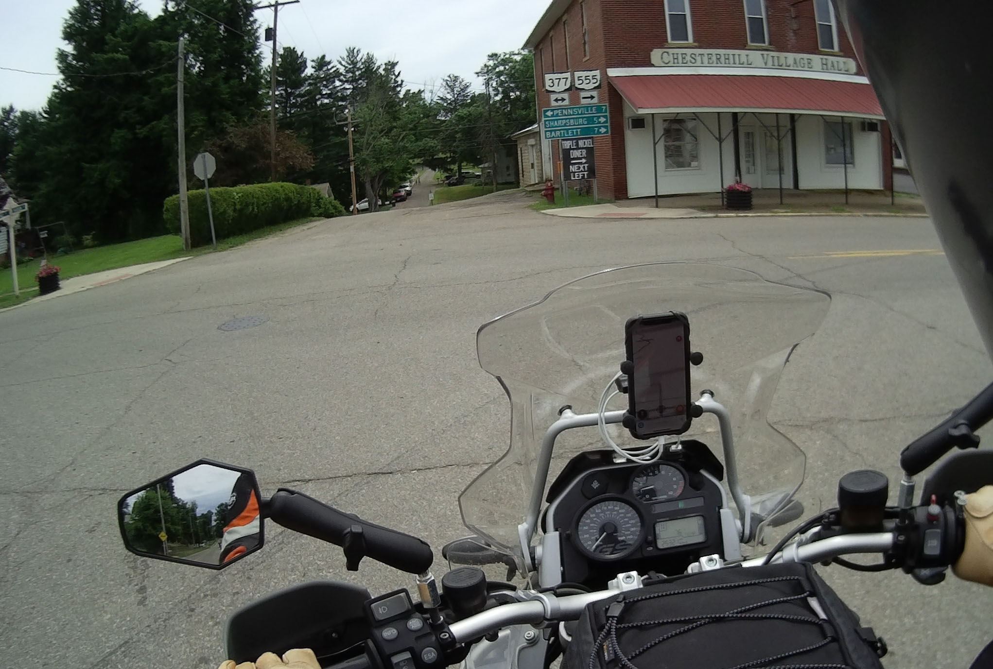
You don’t hit a lot of gas stations along OH-555, and only a few little hamlets, rather than bigger towns, so make sure you plan your fuel accordingly, or bring a little extra. Chesterhill, OH is a bit more than halfway between Zanesville and Little Hocking, and they have a gas station and a diner, if you feel the need to stop or need to fuel up.
Continuing down OH-555, you eventually hit US-50 (yes, the same US-50 that goes all the way to the west coast) in Little Hocking, OH, which finishes up the Triple Nickel route.
US-50 is a divided highway, with two lanes in either direction, that I took eastward, across the Ohio River into West Virginia and, unbeknownst to me, into some amazing riding.

Crossing the Ohio 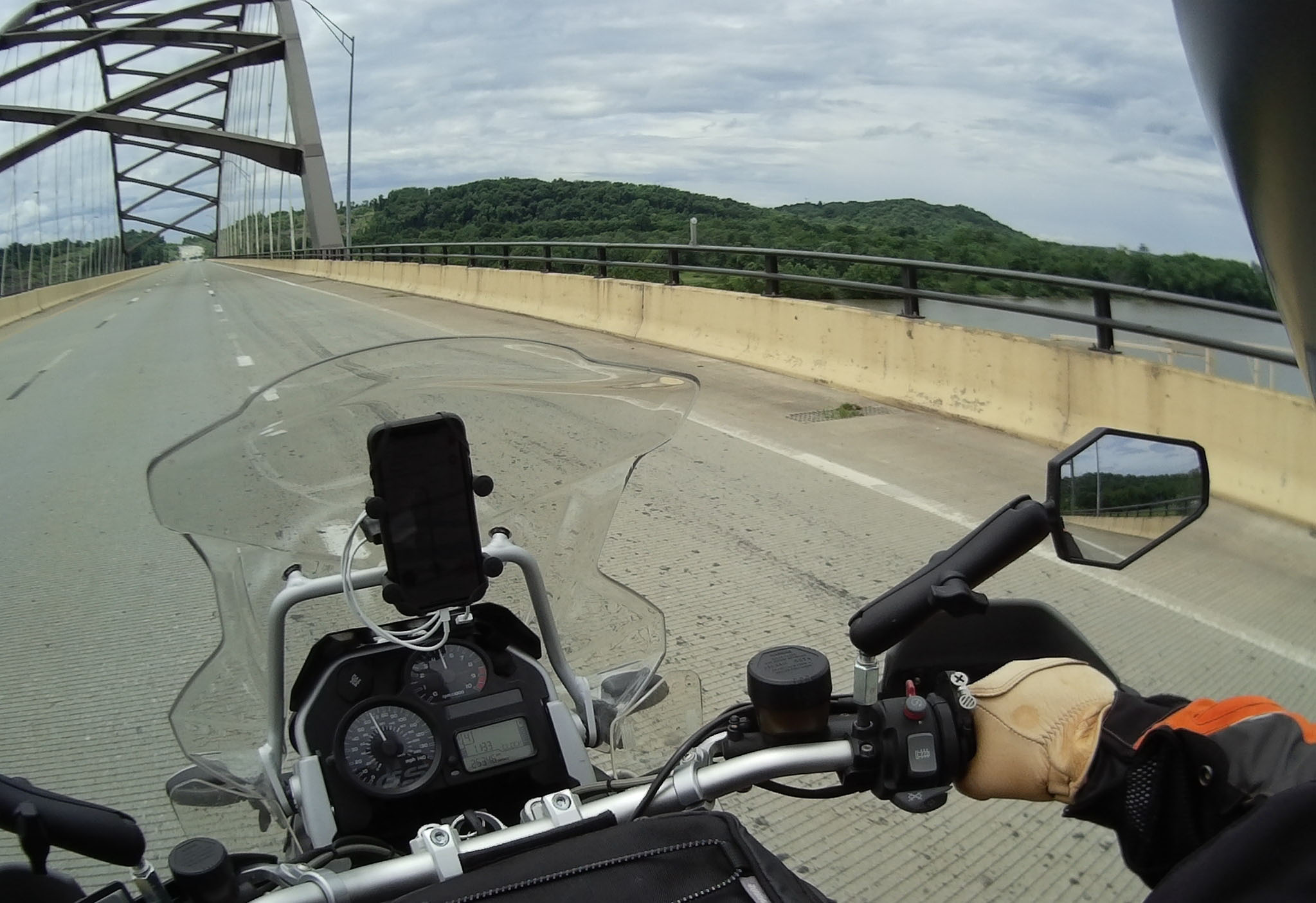
Yup, it’s a river…
On its own, US-50 holds up as a nice ride. Good road surface, sweeping turns, and hills to keep it interesting, but once you get off US-50, it’s like you enter a motorcyclist’s dreams. While I could have stayed on US-50 and caught US-250 in Prunytown, WV (I love that name), I chose to get off on Highway 19 near Clarksburg, WV and follow the West Fork River south to Highway 119, which becomes Highway 48 going east. I followed my nose along Highway 48, through small towns like Yokum, WV, to catch Highway 250 just west of Monongahela National Forest and that’s where things went up a notch (and about where the rain started).
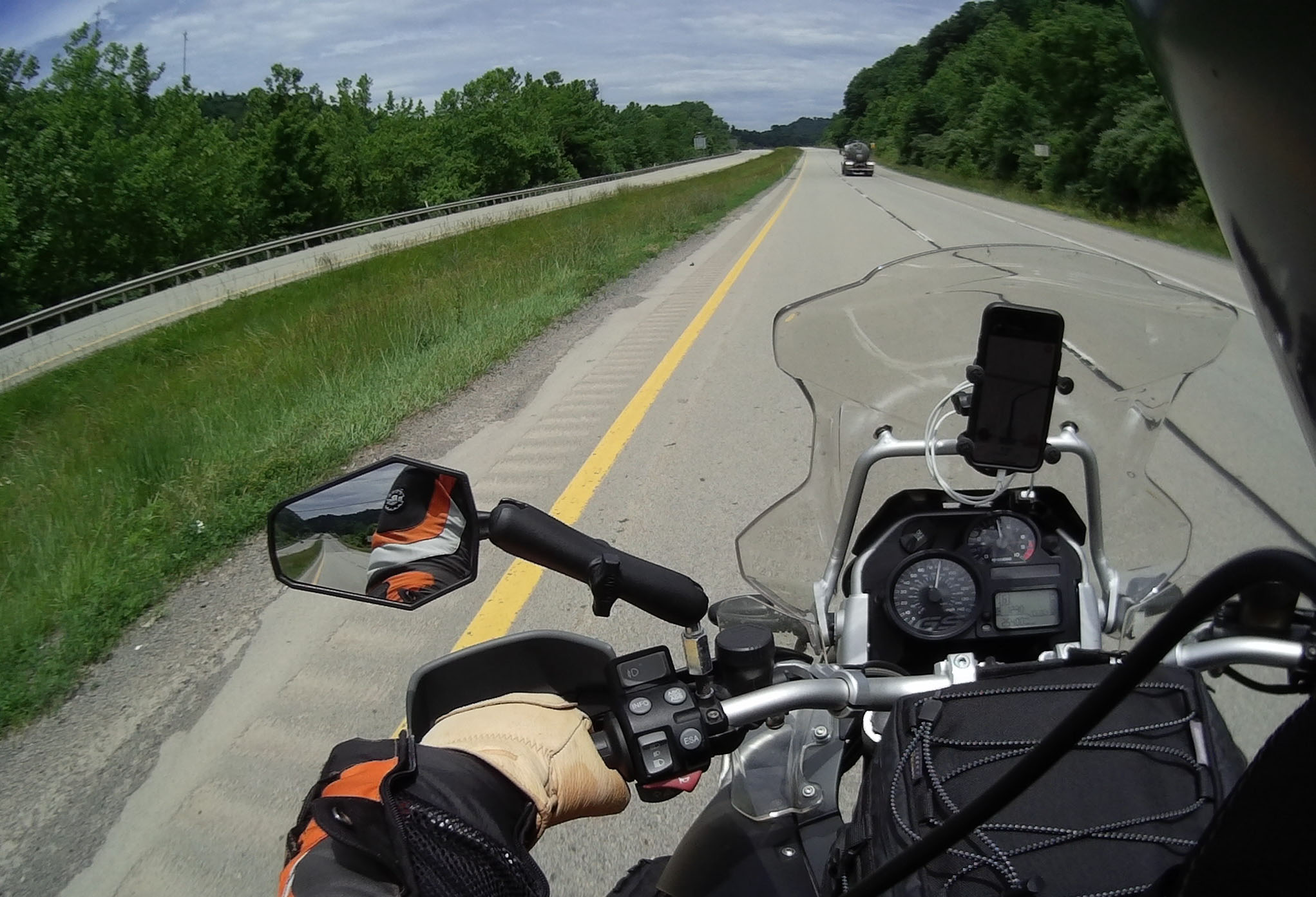
Highway 50 
It’s a nice road
Highway 250 follows the western border of the national forest for a bit, then turns east. As you make your way up into the hills, the trees close in on you and the turns get a bit sharper. As the rain had started as some sprinkles, as I went up in elevation it became more steady, but I didn’t even mind, as the bike just carved through the turns and there was very little traffic.
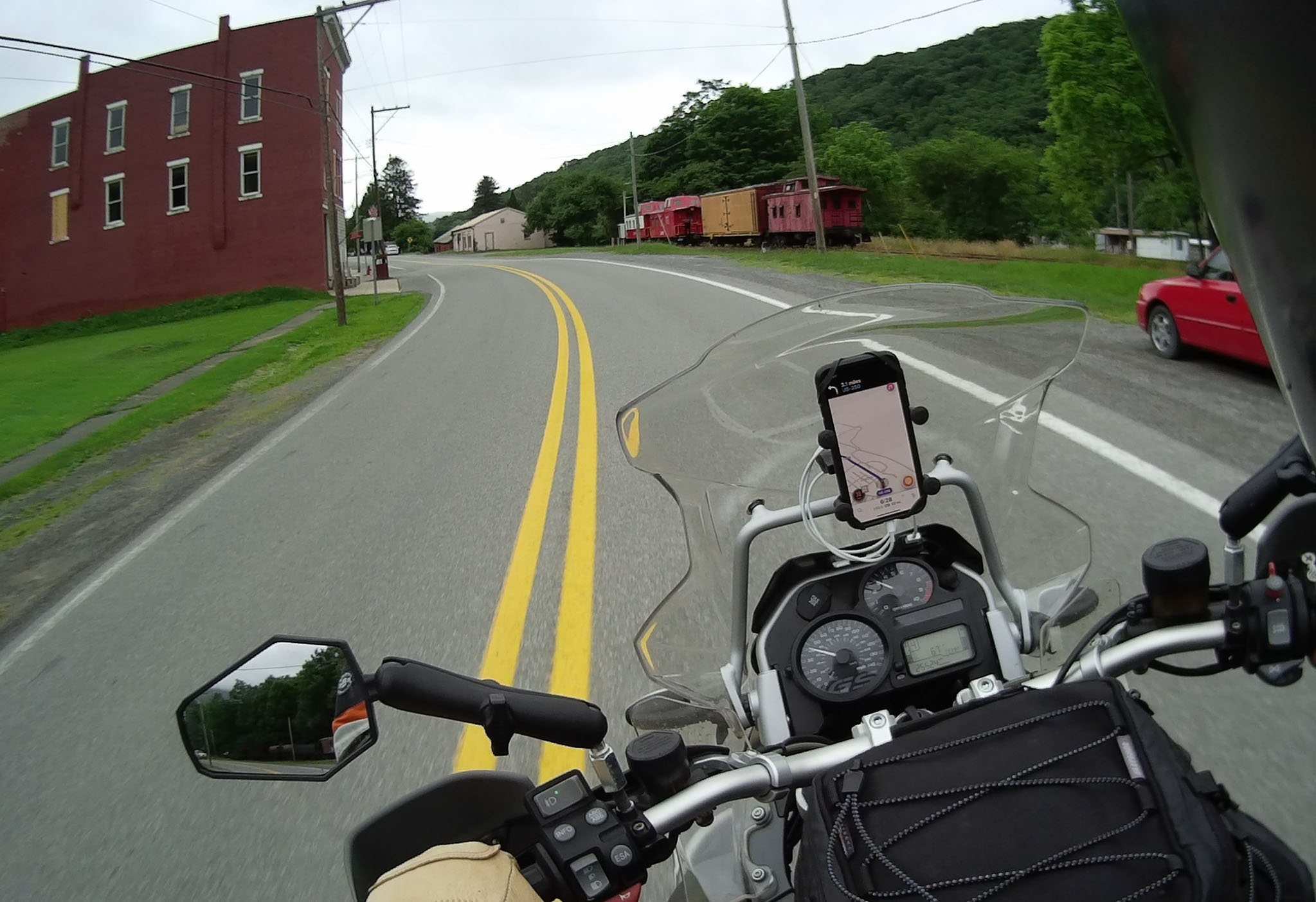
You see interesting things along the road… 
Leaving Monongahela NF
You make your way up to the top of the hills, and then back down again, passing through several small towns along the way. as you drop down into a valley and exit the national forest, you eventually come into a town Monterey, VA where you can stop for gas and a quick drink & snack before heading toward the George Washington and Jefferson National Forest.
George and Thomas don’t disappoint. Plenty of switchbacks and reducing radius turns can challenge you even when it isn’t raining. Since it was raining, I had started to really develop a trust for how my bike, and more importantly my tires, handled wet pavement. This would certainly come in handy over the next several days.
I would be remiss not to mention some of the historical sites along Highway 250. As I was a bit cold and wet, I didn’t stop, but there were several civil war sites along the way, including some confederate ramparts, a site of a fort and at least one battlefield. If you are historically inclined, it would certainly be worth some investigation.
I followed Highway 250 all the way into Stauntun, VA where I stayed at the glorious Super 8 Motel. Of course, it was pouring down rain by the time I got there, everything I had on was soaked, and they put me in the room the furthest from where I could park… I decided this called for a Five Guys burger and a quick run to Walmart for some waterproofing spray. I tried to dry as much as I could with the hair dryer, but it was kind of a lost cause. I just resigned myself to being soggy the next day…
PRO TIP: Radar detectors are ILLEGAL in Virginia, don’t get caught with one!
Day 3: Enter the Parkway…

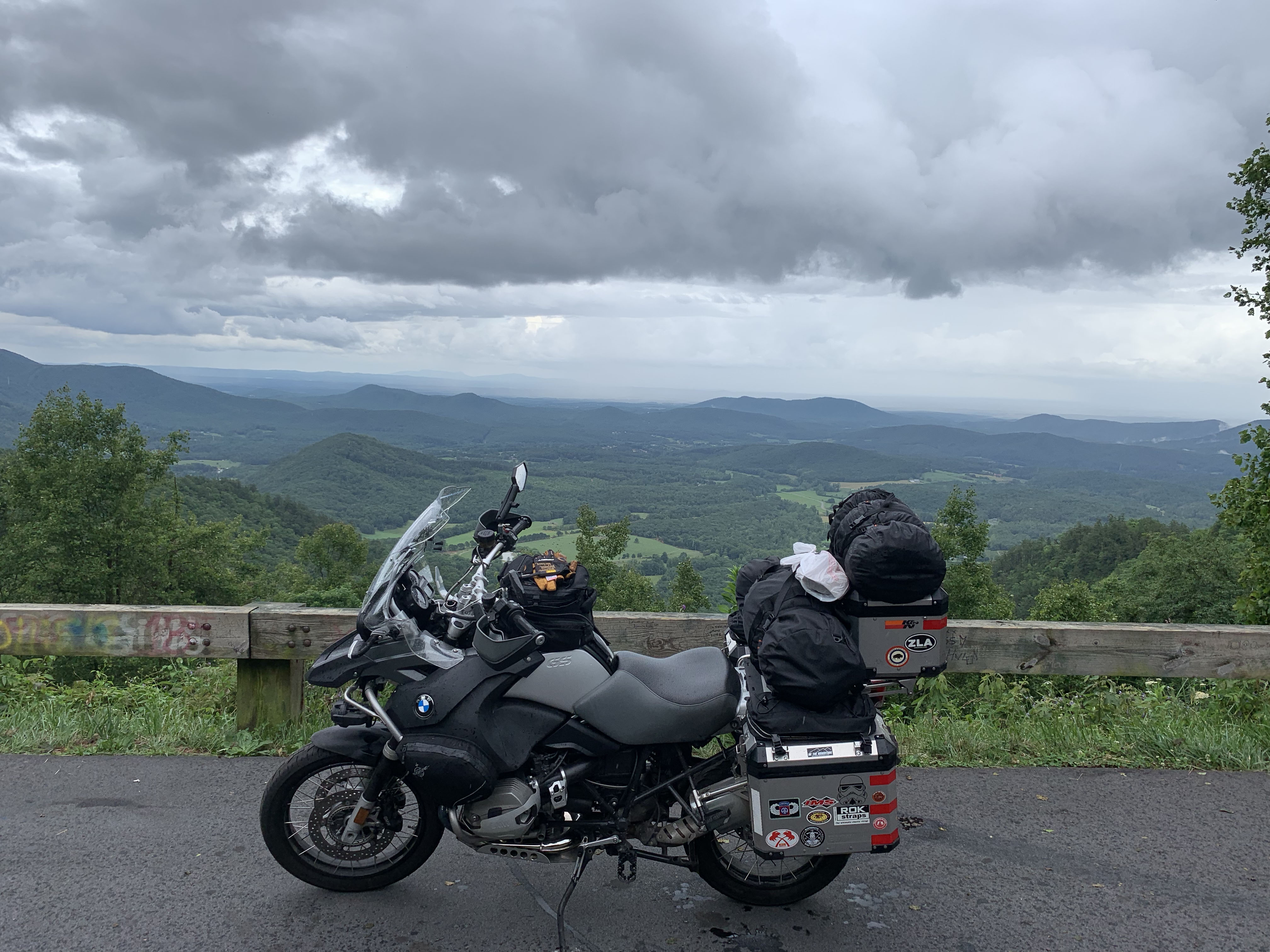
It’s 469 miles long and stretches from Shenandoah National Park in the North, to Great Smoky Mountains National Park in the south. It runs along the spine of the Blue Ridge Mountains and has a posted speed limit of 45 mph. It is the Blue Ridge Parkway, and it is amazing.
I had some concerns taking it for the full length, particularly with the reported traffic and the low speed, but I thought I should give it a try. Worst case, I could jump off and take different roads, right?
Before heading to the “BRP”, I needed some breakfast. Where do you go for breakfast when in Virginia? Well, you go to Waffle House and get some eggs and some smothered & covered hash browns. It is the law.
After that fantastic breakfast, I headed for the BRP. Luckily for me, it was rainy and there was a low ceiling. So, for my entire first day, I had the road to myself almost the entire way. The rain kept the deer down, so I only saw one, and while I had to slow down in the highest elevations for fog, I mostly got to run at whatever speed I wanted.
It was a freaking blast!
Somewhere along the way, I decided to stop at a random picnic area and rest a bit, as well as have a bite to eat. It was a pretty standout experience in a trip of great experiences.
First off the picnic area isn’t just a couple of old wood picnic tables in a clearing. As you turn off the parkway, you go down a dark, narrow road where there are individual parking spots carved out of the woods. You park in one of these and then make your way to your picnic table, which is hewn from the bedrock in the immediate vicinity.
I was all alone in the picnic area and could only hear the sounds of the forest, and the wind through the trees. I heated up an MRE and drank some water while waiting, just listening to the silence. I miss silence. No cell coverage, no Twitter, no email, no music, no traffic, no planes overhead, no white noise… Just the quiet rustling of leaves and the occasional critter running by.
What was really cool was I could also hear the rain approaching from across the valley and had several minutes to pack up and get back on the road before it hit. I had never experienced that before and it stands out in my mind as a pretty cool part of the trip.
However, I also ran into some of my first logistics problems. First off, I was using Waze as my GPS. The problem with Waze is that it needs connectivity to preload maps along your route. When you lose service, your maps can vanish. When running down a curvy road at speed, that’s no bueno. So, it was on this trip I decided I should look at a dedicated motorcycle GPS. You can preload google maps, to be clear, but I just figured I should go with a dedicated unit as it’s weatherproof and glove friendly.
The second logistical issue was related to the GPS problem, but had to do with lodging. Remember how I was booking stuff as I went? Well, when you are booking at the top of a mountain on the Blue Ridge Parkway when you finally get one bar, you might not be able to download maps for your GPS app. This situation led to my first real “oops” of the trip. My motel had a mailing address in West Jefferson, NC, but it really wasn’t located there, so I ended up going quite a bit out of my way to get there. Without cell service, or a good map, I was really riding blind.
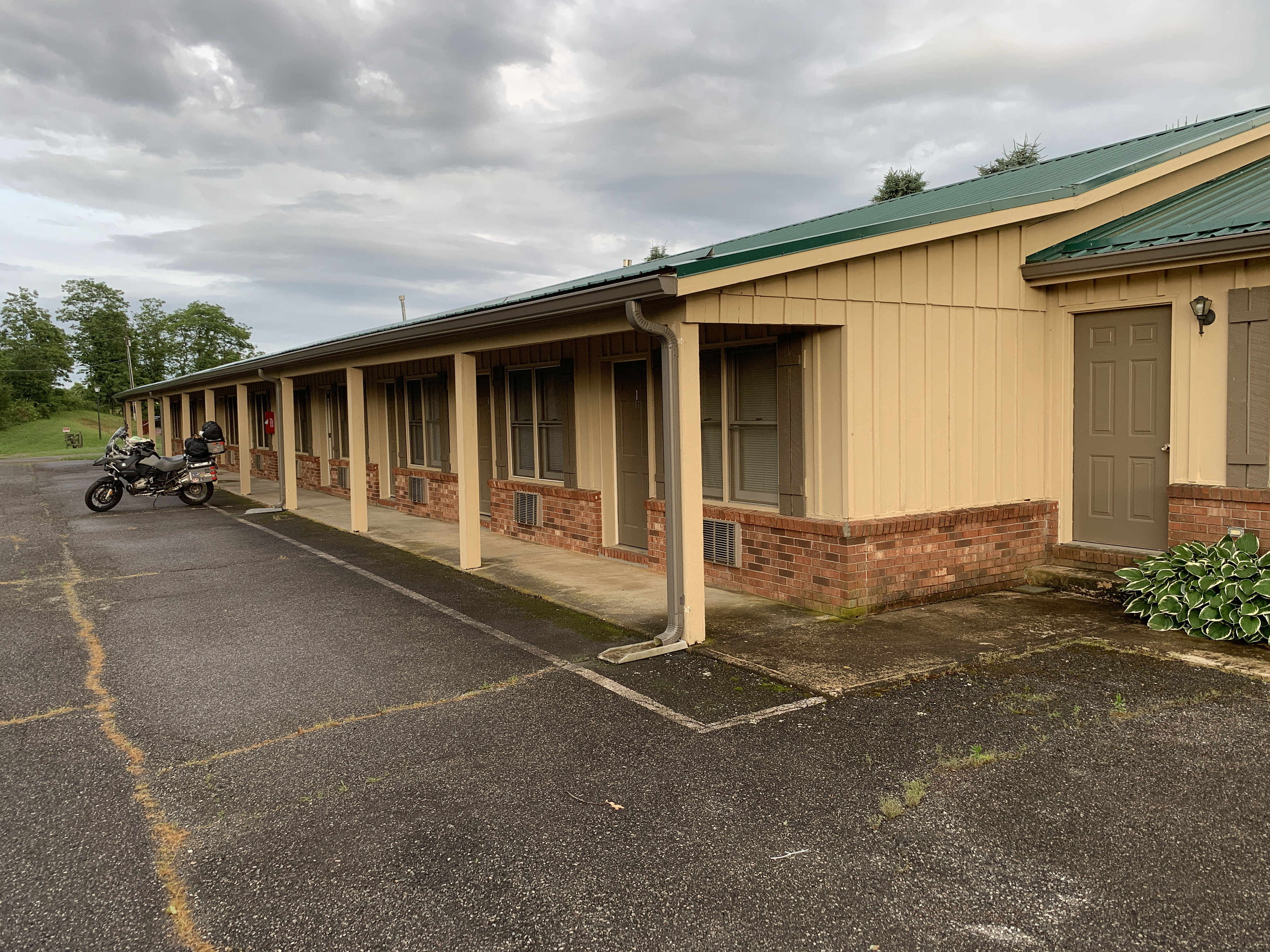
My motel, I was the only guest… 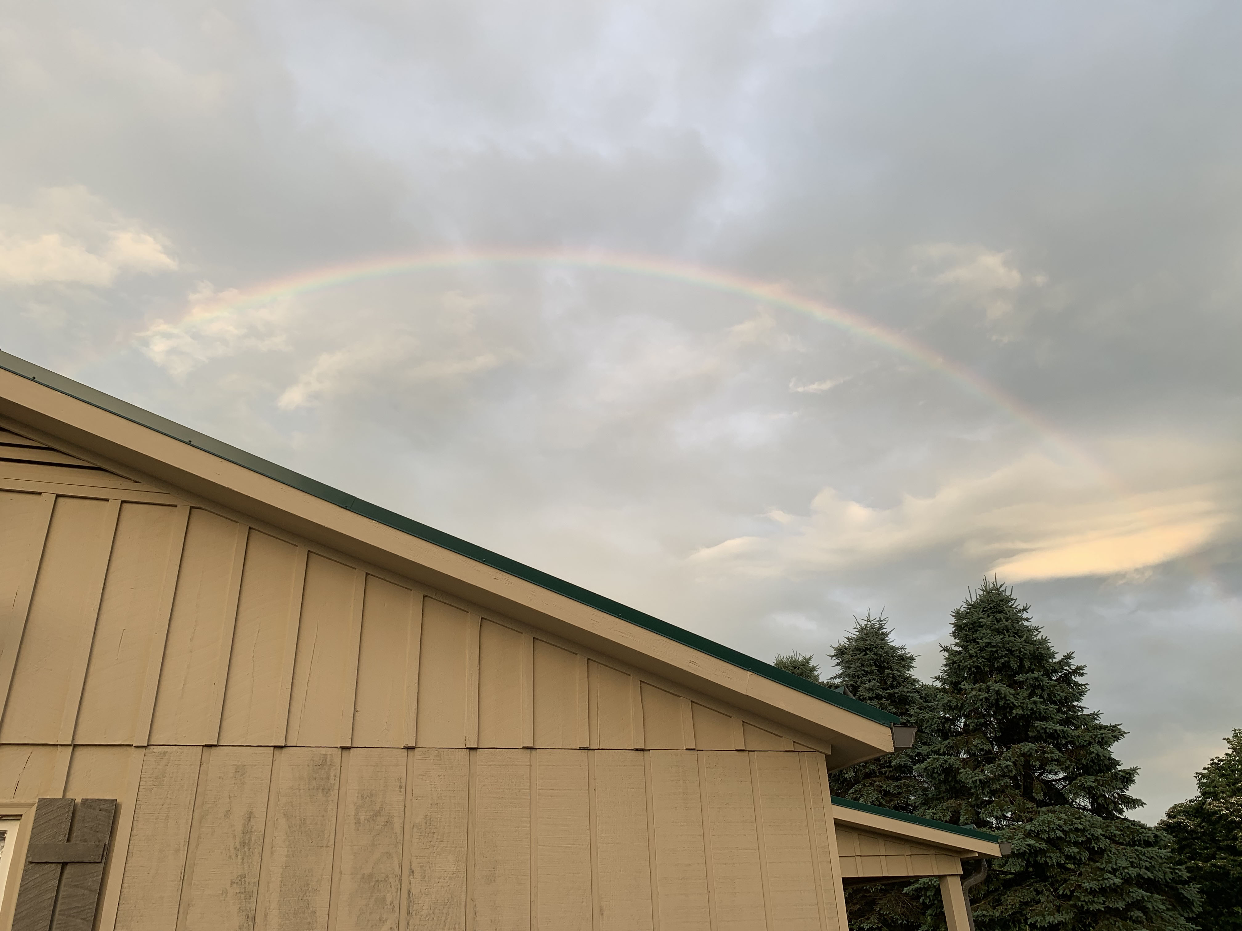
It was at the end of the rainbow though
PRO TIP: If using Google Maps as your GPS app, be sure to turn off the “shake to report problems” option in settings. Otherwise every time you go over a bump, a stupid popup blocks your view of the map.
All-in-all, I loved this day of riding. I was damp, I was tired, and my motel had no cell service and extremely spotty wifi, but I had stopped to get a sandwich and I got to dry out some of my gear, so all was good.
Day 4: Parkway part deux…
Remember that little detour I ended up taking to get to my hotel last night? Well, when I checked out I asked the owner the easiest way to get back on the BRP and he looked at me like I was a fool. Seeing I was serious, he kind of shook his head and said, “Go out of the parking lot, turn right and go about 150 feet…”
That’s right, I had gone about 90 minutes out of my way to get to a motel that was 150′ off the parkway. I am an idiot.
The owner also sent me up to the local greenhouse for breakfast. There was a diner/ice cream parlor sort of tacked onto the side of the building, and it was delicious. All the locals stared at me, sure, but the food was good and there was plenty of it.
After eating, I fired up the bike and saw that it was telling me my headlight was out. Of course, I usually travel with a spare, but I had forgotten to put it in the tool box.
Idiot status… Confirmed!
So, I’m running my high-beam and I now need to stop at the BMW dealer in Asheville (glad there is one there). However, the weather is really nice and the road is dry, so off I go.

The road continued to amaze me, but there was a bit more traffic today, as it was nicer out. Luckily there were plenty of turnouts and opportunities to pass as I went, so I didn’t get slowed down too much. One thing I did learn to loathe were people pulling large campers. Those SOBs would make a tight turn and come into your lane without even honking to warn you.
I eventually got to Asheville (after going through some dark tunnels with only a high beam, which isn’t optimal) and made my way to the BMW dealer. The service manager was awesome and offered to swap out the bulb (it’s a bit of a pain with big hands) and in about 30 minutes, I was back on my way, after drooling over the 2019 model of my bike.
After a few more hours of nice road, fun turns, tunnels, and great views, I arrived at Great Smoky Mountains National Park. As I got off the Parkway, I headed west-ish on Highway 441 toward Gatlinburg, where I would be spending the night and meeting up with a friend and his Girlfriend for the next day’s ride.
However before I could get there, I had to deal with an interesting phenomenon of National Parks. Wildlife roadblocks.
As I headed up into the hills, traffic suddenly came to an intermittent standstill/crawl. After about 40 minutes, I found the cause. A lone elk, standing about 40′ off the road, eating grass.
People were stopping their fucking cars in the road, getting out, and taking pictures/selfies. IT’S A FUCKING ELK PEOPLE!
Anyway, once I got past that debacle, I was able to enjoy the rest of the ride along streams, through more mountains, and through the entire park to Gatlinburg, which was… Something.
Now, I don’t want to go off on a rant here, but I’ve got a bone to pick with towns like Gatlinburg. If you’ve never been there, trust me, you probably already have and just don’t know it. Gatlinburg is just like the Wisconsin Dells, Keystone, SD, or any other town outside of a major tourist attraction. Loads of pancake houses, candy stores, confectionaries, souvenir shops, ice cream parlors, and usually some “experience” vendors like zip lines, duck tours, or kayak tours… It’s a tourist trap designed to pry open your wallet so you can buy too much useless shit. Oh, and it’s packed with people.
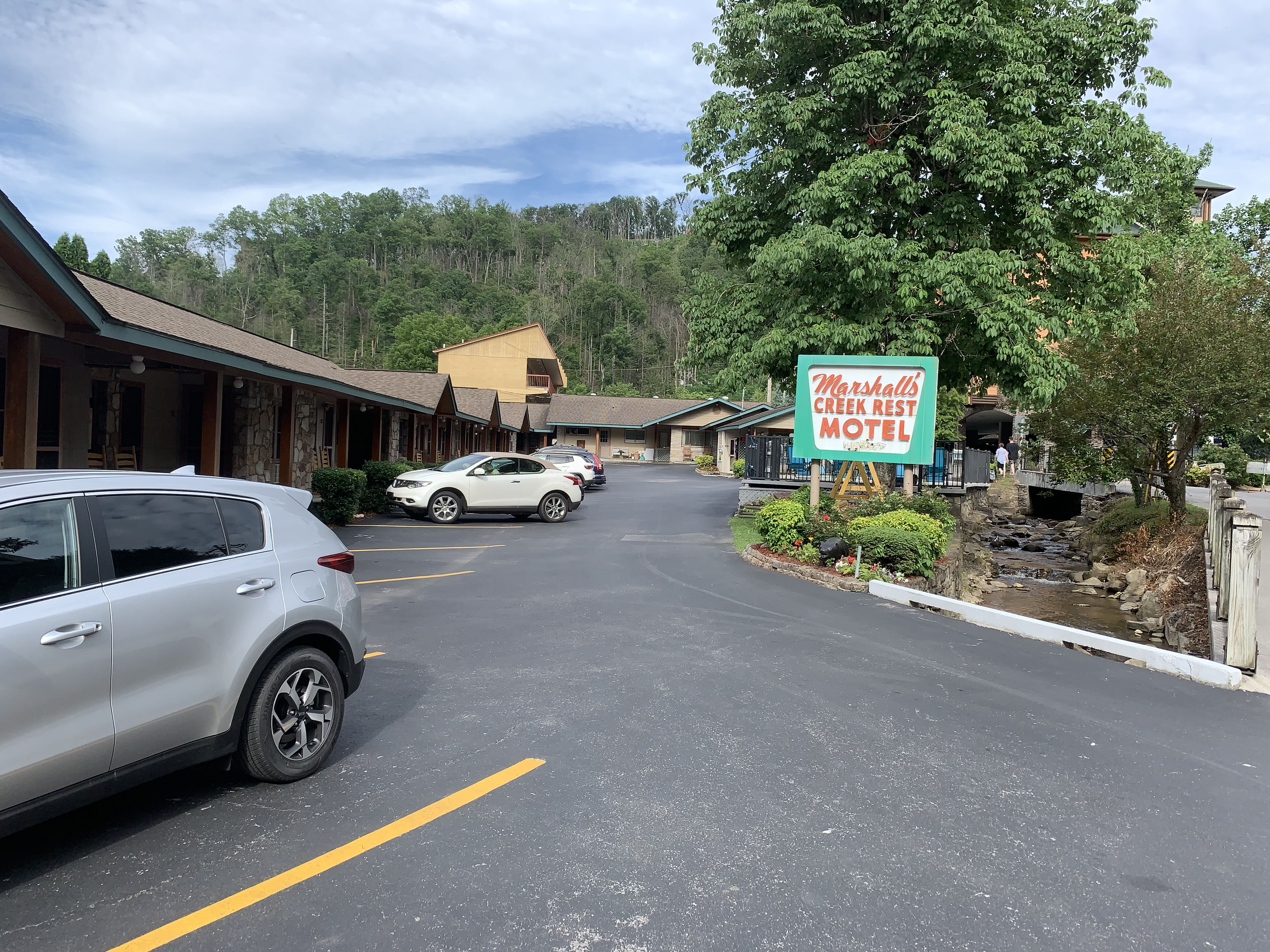
My retro motel 
seriously retro…
So, I crawled my way down the main drag and found my way to my funky little throwback motel. From there I walked to a Mexican restaurant and had a mediocre burrito and a passable margarita. Then I went back to my room and organized my stuff for the next day.
Day 5: Riding stuff of legends

So, today was the day for the infamous “Tail of the Dragon”. This road is legendary in motorcycle circles, as it boasts 318 curves in 11 miles. So, I met up with my friend John and his Girlfriend Kim and we headed in that direction. First though, we wanted breakfast. Oh, and did I mention it was raining?
We jumped on Highway 321 heading north-ish out of Gatlinburg and made our way up to Pigeon Forge, TN. Remember all that stuff I complained about regarding Gatlinburg? Well, repeat it for Pigeon Forge. We rode through and continued down 321 as it turned toward the southwest and headed to a place called Elvira’s Cafe for a nice breakfast. After that, we got on all of our rain gear and headed back to the entrance of the Foothills Parkway.
The Foothills Parkway winds its way south along the western end of the Great Smoky Mountains National Park. It seems to be a pretty new road, and really well maintained and we enjoyed the entire ride. Today, I was riding behind my friend, which is always an adjustment after several days of being on my own, but as with all things, you make do.
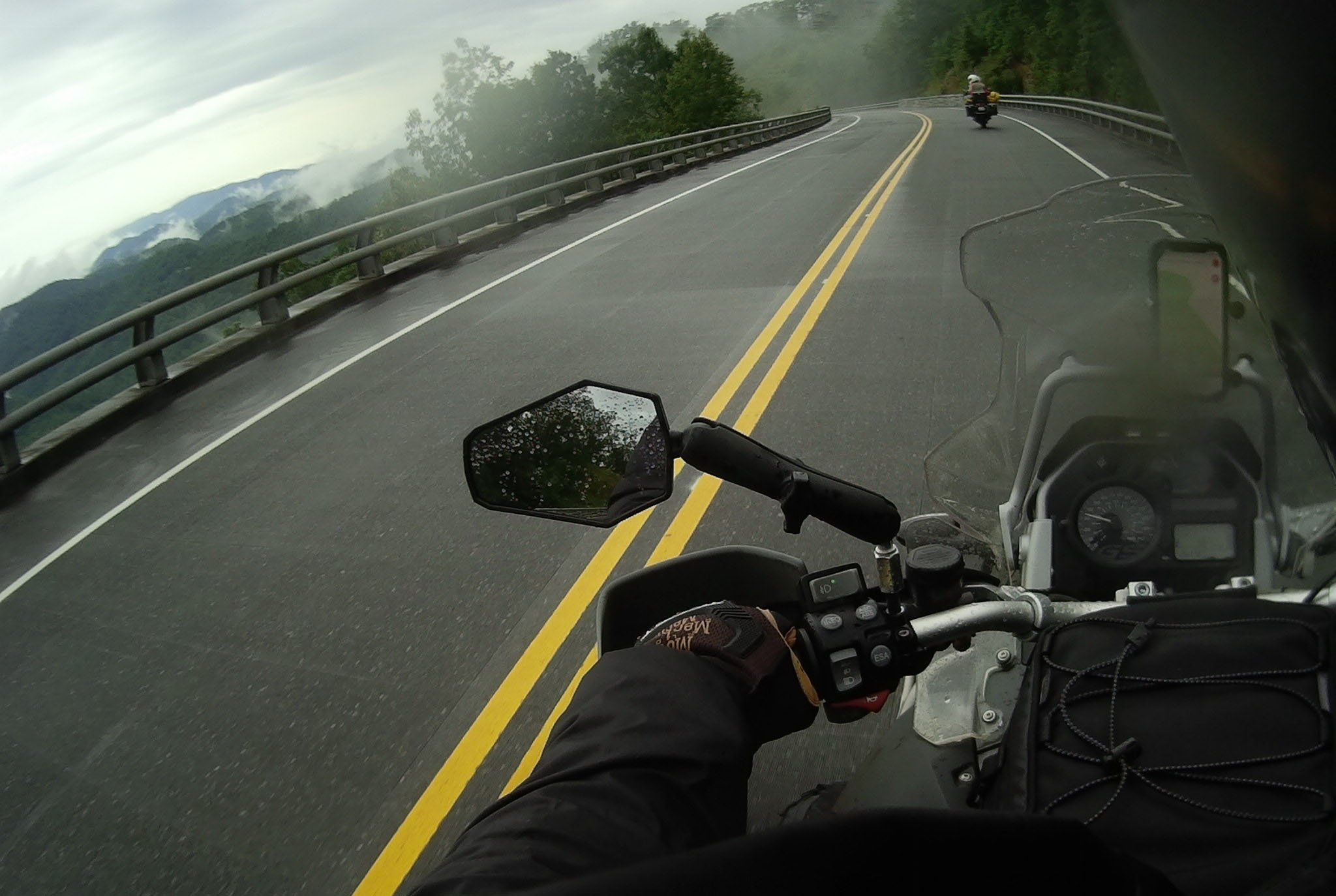
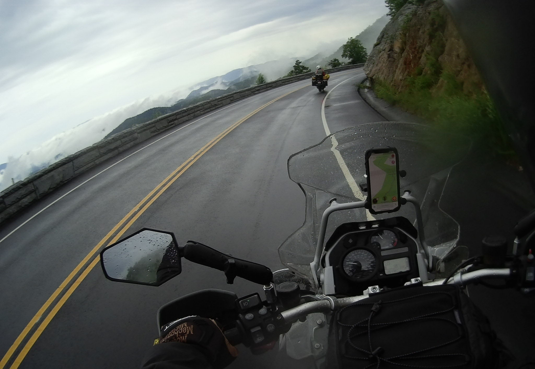


We rode in and out of rain and mist, and there were some pretty nice views from the Parkway as we headed down toward Highway 129 and the Tail of the Dragon.
The Parkway ends at Highway 129 right at the edge of the Chilhowee Lake, where you turn east and head toward the Tail of the Dragon. There were several warning signs about the road ahead, but we pressed on and made our way through the route.

Now, let me tell you about the road. There are a lot of turns, a lot of them are incredibly sharp (like full switchbacks) and there are a lot of people on the road. When you’re riding a fully loaded adventure bike, behind a couple riding 2-up on a fully loaded bike, you aren’t going to be carving corners too hard. Also, to be quite honest, about halfway through, I was kind of over the novelty of it.
On a couple of the more dangerous turns, there are photographers taking pictures of bikes so they can sell them to you (or the press, if there is a crash), and there are some distractions along the way, so I see why people crash, but at the end of it all, we made it through unscathed and we got the sticker. I can now say I did it, not sure I’d go out of my way to do it again.
It’s me! 
Sticker shot!
After we stopped for a bit at the western end of the dragon, we wanted to take another famous road, the Cherohala Skyway (Highway 143), so we continued east on 129 until we met up with Highway 143, where we headed in a westerly direction again.
Like all the other roads, the Cherohala was pretty amazing for a guy from Illinois. Nice road surface, sweeping turns, great views. Just a fun ride back into Tennessee that I would highly recommend.
The skyway ends in a little town called Tellico Plains, TN, where John and Kim headed back to Knoxville to meet up with his dad and I headed toward the Rally in Lebanon, TN. To get there, I rode another great state highway, TN-68 all the way up to Crossville, TN. There I merged into TN-127, made my way through town and then got on I-40 westbound, thinking I’d bomb down the Interstate and make good time to my hotel in Lebanon.
I was wrong.
First, I saw a lightning strike and figured I should get off at the next exit and put on my wet weather gear. About the time I finished that thought, the skies opened up. I couldn’t see 30′ in front of me and I had a couple miles to the next exit. I put on my hazards and got on the shoulder to crawl along toward it. A thoughtful trucker saw me, put on his hazards and ran just behind me, blocking me from getting hit, I wish I could thank him. Anyway, I got off the interstate, got under an overpass and chatted with all the other riders I found there. We all got on our wet weather gear and headed out as the rain slacked off.
I got back on the Interstate, went about a mile and traffic stopped. I mean completely stopped. Oh, and the sun came out and the temperature started to climb.
I was stuck in the traffic jam for about 40 minutes. The cause of it ended up being an SUV that rolled over during the downpour, but man, traffic jams suck on a bike on a hot day.
After getting past that, I eventually got to Lebanon, TN. The rally didn’t open until the next day, so I spent a night in a Ramada Inn about 2 miles away from the fairgrounds. I also managed to find some pretty good Thai food for dinner.
Days 6 & 7: We Rally
So, there was no real riding for the next couple of days because, while setting up my tent at the rally, I noticed my tires were worn way down. This led me to buying a new set at the rally and having the vendor install them, which led me to not have my bike for the entire day on Friday. Kind of a bummer, but better than being stuck on the side of the road waiting for roadside.
I did get to test ride the 2019 version of my bike, which was a mistake, as I now want one, and I did get to buy accessories for my bike, got a new helmet (which I needed) and met some cool folks. By Saturday morning though, I was ready to head home and see the family…
Day 8: Shortest distance between two points…

As you can see from the map, there wasn’t much exciting about this ride other than the weather. Lots and lots of rain all the way from about Indianapolis to home. The new tires were great though and, well, I was used to being wet by this point. I got home safe, and that is all that mattered.

So, that was my extra-long trip to Tennessee. I hope you enjoyed the narrative and I’d be happy to answer any questions you may have, or share any route specifics.
Oh yeah, next year’s rally is in Great Falls, Montana… That should be an epic ride.
